
For “west vs east Sumba which side” the simplest answer is this: choose the West and Southwest if you want greener hills, lagoons, villages and Pasola country; choose the East if you prefer drier savanna, Waingapu’s ikat heritage and Walakiri’s tidal sunsets. With five to seven days, we recommend you bridge both.
The geographic split: how Sumba is actually laid out
Before deciding should I stay west or east Sumba, it helps to understand how the island is organised on a map and what that means on the ground.
Four regencies, two distinct moods
Administratively, Sumba is divided into four regencies:
- West Sumba (Sumba Barat) – capital: Waikabubak
- Southwest Sumba (Sumba Barat Daya) – capital: Tambolaka / Waitabula
- Central Sumba (Sumba Tengah) – capital: Waibakul
- East Sumba (Sumba Timur) – capital: Waingapu
The “west vs east” conversation is really about the character of the western half (West + Southwest + much of Central) versus the eastern half (East Sumba). Each has its own rhythm:
- West / Southwest / much of Central Sumba – receives a bit more rain, with greener hills in the wet season, pockets of forest, rice terraces, more rivers and coastal lagoons. Villages tend to sit closer together.
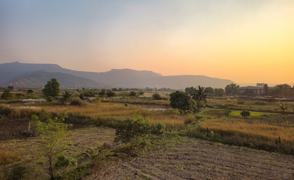
- East Sumba – classically drier and more open. Wide savanna, rolling hills, scattered lontar palms and horses. The coastline swings from mangrove-backed flats to long, exposed beaches.
Across the island, the dry season typically runs roughly May–October, and the wet season November–April. In practice, the western side generally feels lusher for a longer stretch of the year, while the east holds onto its savanna character even at peak green. We will never promise clear skies; the island sits squarely in a changing climate and weather is variable year to year.
Population and access density
Another key difference west east Sumba is how people and roads are distributed:
- West/Southwest – denser clusters of traditional villages, more Catholic and Protestant missions, and more of the classic “marapu megalithic village on a hill” scenes. Secondary roads can be rough but there is a long history of overland circuits from the western airport.
- East – the largest single town on the island, Waingapu, with the main commercial port, a modest selection of shops and simple eateries, and easier access to fuel and basic services. Once you leave Waingapu, settlements thin out quickly into ranchlands and scattered hamlets.
Your choice of base is therefore a choice of landscape, but also of logistics and daily driving time. We will unpack that below with a side-by-side view.
What each side is best for: beaches, villages, savanna, ikat, sunset
Most private travellers who ask us about choosing a base in Sumba are weighing a handful of specific interests. Here is how they naturally align.
West & Southwest Sumba: greener, village-rich, Pasola country
We recommend anchoring in the West/Southwest if your priorities are:
- Traditional villages in reach
West Sumba and parts of Central are where you feel the greatest density of iconic hilltop and plateau villages with high-pitched thatched roofs and megalithic tombs. Several are accessible as half-day outings without long overland pushes from a western base. The closer you move inland from the coast, the more these villages cluster. - Greener rivers, lagoons and rice fields (season-dependent)
In and after the wet season, the western side offers more rivers, small waterfalls and rice terraces that actually hold water. “Blue lagoon” style river bends and estuaries tend to be more frequent on this side, though exact colour and clarity vary with recent rain and tides. - Pasola heartland
The most famous Pasola arenas sit in West Sumba and Southwest Sumba – think Wanokaka, Lamboya, Kodi and surrounding districts. Pasola is a ritualised spear-on-horseback encounter between villages, tied to the marapu calendar and the arrival of sea worms (nyale). Dates are set by traditional priests and typically fall around February–March, but vary annually. We maintain an updated Pasola guidance page; for current-season expectations, contact us directly. - More varied coastal topography
The western shoreline includes headlands, coves, some surf breaks and more pronounced changes between high and low tide. Swimmability, wave exposure and rip risk all vary beach to beach. We insist on up-to-date local guidance wherever you are staying; conditions change with swell, wind and season.
If your image of Sumba is stone tombs aligned along a village spine, children herding buffalo through bright green fields, and horses appearing on a bluff above the sea, the West and Southwest most often match that mental picture.
East Sumba: dry savanna, Waingapu ikat and Walakiri’s tidal trees
We suggest anchoring in the East if you are drawn to:
- Open savanna and rolling hills
East Sumba is where the island feels almost otherworldly: vast, treeless ridges, pale grasses, isolated stands of lontar and distant horses or goats. the dry season, these landscapes lean golden-brown; in the rains, they soften to muted greens but keep their sense of scale and emptiness. - Ikat heritage in Waingapu
Waingapu, the capital of East Sumba, is the island’s main hub for ikat textiles. Here you find co-operatives and small ateliers where natural-dye threads are hand-tied, dyed and woven into story-rich cloths. The most intricate pieces can take months or even longer to complete and are priced accordingly. Serious collectors should plan focused time in Waingapu with an interpreter who understands both the textiles and the local etiquette. - Walakiri’s signature sunsets
Walakiri Beach, just outside Waingapu, has become known for its mangrove and pandanus trees emerging from the tidal flats at low water. Photographers and casual visitors alike time visits to the interaction between low tide and sunset. Colour, cloud form and tide height change daily; patience produces better images than a single rushed stop. - Long views and light
The eastern half rewards travellers who notice changes in light and shadow. Early mornings and late afternoons can turn an otherwise austere hillscape into something quietly cinematic. It is less about “beautiful viewpoints” and more about drifting through a living pastoral environment.
If your priority is space, horizon and a deeper engagement with ikat traditions, East Sumba is a natural base.
Beaches: no single “better” coast
Visitors sometimes ask us bluntly which side has the “better beaches”. The honest answer: neither side holds a monopoly.
- West / Southwest coast – more coves, some reefs, sandy stretches and surf-facing beaches. Certain spots have gentler shallows at particular tides; others are for experienced swimmers only. There is no true resort town; stays are in standalone properties or small clusters.
- East coast – longer, more linear sandy sections and mangrove-fringed bays. Water movement can feel milder in some corners and very exposed in others. Walakiri is not primarily a swim beach; it is a tidal, photographic one.
Nowhere in Sumba is a controlled, lifeguarded, fully serviced “beach club” context. You are entering live ocean environments with shifting currents. That is part of the island’s appeal and risk. We always suggest you confirm local conditions daily with your host and avoid remote swims without support.
Airports as anchors: TMC in the west, WGP in the east
Your flight choice often pre-determines how you think about west vs east Sumba which side to stay on. Sumba has two commercial airports:
- Tambolaka Airport (TMC) – in Southwest Sumba, near Tambolaka/Waitabula. This is the western gateway.
- Umbu Mehang Kunda Airport (WGP) – in Waingapu, capital of East Sumba. This is the eastern gateway.
Both currently connect primarily via Bali or Kupang with domestic carriers; routes and schedules shift periodically. We track these patterns on our dedicated getting there pillar and suggest you treat any airline map as provisional until you have a confirmed ticket.
Choosing a base around Tambolaka (TMC)
If you fly into TMC, you are naturally well-positioned for:
- West/Southwest coastal stays with easier transfers
- Day trips into traditional villages inland of Waikabubak
- Reaching Pasola fields in West and Southwest Sumba in season
Driving times from TMC to typical western or southwestern bases range widely depending on property location and road condition. We avoid publishing exact point-to-point times that can mislead, but as a pattern, you should expect anywhere from under an hour for nearby coastal zones to multiple hours for more remote peninsulas or interior valleys.
Choosing a base around Waingapu (WGP)
If you arrive via WGP, you sit at the natural hub for:
- Ikat-oriented exploration in and around Waingapu
- Walakiri sunset excursions
- Access to the eastern savanna belts and hill drives
From Waingapu you can drive inland towards Central Sumba or arc along the coast in either direction. Outside town, services thin quickly, so refuelling and provisioning tend to centre on Waingapu itself.
Bridging both sides: overland west–east in a single trip
The most complete way to internalise the difference west east Sumba is to stay on each side once. This is fully viable for private travellers with the right time budget.
Overland link: roughly 3–3.5 hours west–east
The main road between the western and eastern halves runs via Waikabubak and across Central Sumba towards Waingapu. On a normal day, with sensible driving and no extended photo stops, the central west–east overland run is typically in the 3 to 3.5-hour range. Road works, weather, livestock and village life can lengthen this; we prefer to plan conservatively.
As of our last island-wide review (mid-2026), the spine road is paved most of the way but with segments of patchwork and occasional rougher patches, particularly off the main axis. Night driving is not recommended due to animals and limited lighting.
How many days to allocate
To bridge both sides without turning your stay into a sequence of transfers, we suggest:
- 5 days / 4 nights – minimum to meaningfully sample both: for instance, 2 nights west, 2 nights east, with the transfer day used as a rolling landscape and village day.
- 7–8 days – allows a more relaxed structure: perhaps 3 nights west, 3 nights east, plus 1–2 nights flexible for Pasola timing, extra village time or a deeper ikat session.
More than eight days opens up more specialised interests (riding, multi-day textile learning, or quiet time based in one marapu community). Below that, you are trading depth for range and need to be honest with yourself about which side aligns best with your priorities.
If you would like a neutral sounding board for this decision, you can always plan your trip with us by email or WhatsApp. No one can pay to change what we publish; if you proceed with our partner they may pay us a referral fee at no extra cost to you.
Side-by-side: West vs East Sumba at a glance
| Aspect | West / Southwest / Central (western half) | East Sumba (eastern half) |
|---|---|---|
| Primary airport | Tambolaka (TMC) – Southwest Sumba | Umbu Mehang Kunda (WGP) – Waingapu |
| Landscape character | Greener (in season), rivers, lagoons, terraces, villages closer together | Drier savanna, rolling hills, wide skies, scattered palms |
| Main town | Waikabubak (West Sumba capital) | Waingapu (East Sumba capital and largest town on the island) |
| Traditional villages | Higher concentration of classic megalithic villages within day-trip reach | Villages present but more spread out and framed within ranchlands |
| Pasola arenas | Core districts in West & Southwest Sumba (e.g. Wanokaka, Lamboya, Kodi areas) | Some Pasola traditions exist but eastern half is less associated with marquee events |
| Ikat focus | Scattered weavers and villages, more informal encounters | Waingapu as the island’s main ikat hub with co-operatives and galleries |
| Signature beach experience | Varied coves, cliffs, estuaries, more surf-exposed zones | Longer sandy stretches and tidal/mangrove scenes (e.g. Walakiri) |
| Best for | Village life, Pasola season, greener photography (seasonal), mixed coast–interior | Open-space landscapes, ikat-focused travel, Walakiri sunset frames |
| Typical overland link | Central west–east crossing via Waikabubak–Waingapu in roughly 3–3.5 hours under normal conditions | |
Costs, time and realism: setting expectations
Honest comparison between west and east also means addressing budget, driving and the non-obvious parts of high-net-worth travel here.
Time cost vs experience
Every overland transfer consumes daylight and attention. On a 4-night stay, spending one day largely in transit between halves leaves you only three true exploration days. If your priority is rest or deep time with a single community, concentrating your stay on one side is wiser than chasing a checklist.
On 5–7 nights, adding the cross-island transfer makes more sense: it becomes the connective tissue between two different Sumba expressions instead of a disruption.
Financial ranges (last verified June 2026)
We avoid quoting single fixed prices because they vary by season, occupancy, inclusions and product tier. Instead, for private and high-net-worth travellers, we typically see:
- Private 4×4 with driver – expect day-use rates and transfer costs in line with high-quality Indonesian overland services: more than a basic driver-hire scenario elsewhere in the archipelago, reflecting vehicle wear and road conditions.
- Mid- to high-end accommodation – nightly rates for serious, well-operated properties on either side of the island often sit in the hundreds of US dollars per night per room or villa, with top-end options higher. East vs West is not inherently cheaper; it depends on the specific property and product tier.
- Village and cultural visits – contributions and honoraria are expected across Sumba, west and east. These are modest relative to your overall budget but important locally. Your host or guide should brief you clearly and handle introductions with respect.
If you would like calibrated, current ranges for your dates and preferences, you can plan your trip with us – we are happy to outline likely brackets over email or WhatsApp before you commit to flights.
How to decide: scenarios for choosing a base in Sumba
To give the west vs east Sumba which side question a more practical edge, here are profiles that we see frequently, and how we usually advise.
“I have 3–4 nights total, flying in and out of Bali”
- Choose one side only; do not attempt the whole island.
- If you want Sumbanese villages and potentially Pasola (in season), base West/Southwest, fly via TMC.
- If you are more drawn to ikat, open hills and a Walakiri evening, base East, fly via WGP.
“I have 5–7 nights and want a balanced first impression”
- Split your stay between west and east.
- Example: arrive TMC → 2–3 nights West/Southwest (villages, coast, possible Pasola) → overland 3–3.5 hours via Waikabubak and Central Sumba → 2–3 nights East (ikat, savanna, Walakiri) → depart WGP.
- Or reverse the flow depending on flight inventory.
“My main focus is Pasola”
- Anchor on the West/Southwest near the relevant arena for that year’s schedule.
- Use the East only if you have extra days for ikat or a calmer decompression after the intensity of Pasola.
- Pasola timings are not confirmed by printed calendars; they are decided by marapu priests. Build flexibility and avoid over-structuring your days around an assumed time stamped far in advance.
“Textiles, light and photography are my main interests”
- Base East for Waingapu, ikat cooperatives and Walakiri.
- Add the West if you want contrasting imagery: greener terraces (in season), more megalithic village sets, and Pasola scenes if your timing aligns.
- In both halves, photography is subject to local customs (particularly around tombs and ceremonies). A good guide will keep you on the right side of etiquette.
Cultural respect on both sides
Whichever half you choose, the underlying fabric is marapu belief and Sumbanese etiquette. The West does not have a monopoly on “authentic culture”, and the East is not a secondary act; both are active, contemporary societies with layered identities.
Some baseline principles that apply in all regencies:
- Ask before photographing people or rituals, preferably through your guide or host.
- Dress modestly for village visits and ceremonies: shoulders covered, shorts at least knee-length.
- Understand megalithic tombs are sacred, not props. Sitting, climbing or posing on tombs is deeply disrespectful.
- Budget for contributions at villages and ritual events and let your guide handle the appropriate format for giving.
Part of our role as a curation and concierge-intelligence service is introducing you to partners who understand these nuances. No one can pay to change what we publish; if you continue with one of our recommended partners they may pay us a referral fee at no extra cost to you.
Ask us: calibrating west vs east Sumba to you
This piece is designed as the decision article for west vs east Sumba which side. It does not replace on-the-ground nuance. Seasonal shifts, community calendars and flight patterns change how theory translates into a specific week of travel.
If you would like help choosing a base in Sumba – or shaping a 5-day cross-island plan that connects both halves – you can plan your trip with us. Share your dates, priorities and how you like to travel over email or WhatsApp, and we will respond with honest options and vetted-introduction pathways, not a pre-packaged tour.
Is West Sumba greener than East Sumba all year?
West and Southwest Sumba generally receive more rain and feel greener for more of the year, but both halves shift with the wet and dry seasons. In peak dry months the entire island can look parched; in peak wet months hills across Sumba soften to green. Treat “greener west, drier east” as a broad tendency, not a guarantee.
Can I see Pasola if I stay in East Sumba?
The major Pasola arenas are in West and Southwest Sumba, and reaching them from an eastern base requires significant overland transfers and careful timing. If Pasola is a central reason for your trip, base yourself on the western side and treat any eastern stay as an optional extension.
Is East Sumba only about Walakiri and ikat?
No. Walakiri and Waingapu’s ikat scene are key draws, but East Sumba also offers broad savanna drives, small inland villages, ranching life and long empty stretches of coast. It simply expresses these elements differently from the village-dense western half.
Can I fly into one airport and out of the other?
Yes, many itineraries sensibly fly into Tambolaka (TMC) and out of Waingapu (WGP), or vice versa, using a 3–3.5-hour overland drive as the link. Availability depends on domestic airline schedules for your dates; these can change, so confirm flight options before locking in property combinations.
How many nights do I need on each side to make it worthwhile?
As a rule of thumb, aim for at least two nights on any side you include. With 5–7 nights total, a 2+2 or 3+3 split west–east works well, using the transfer day as a structured landscape and village day rather than an afterthought.